GEMMA FUSION

SDK for geoenvironmental modeling and spatial datafusion

Overview

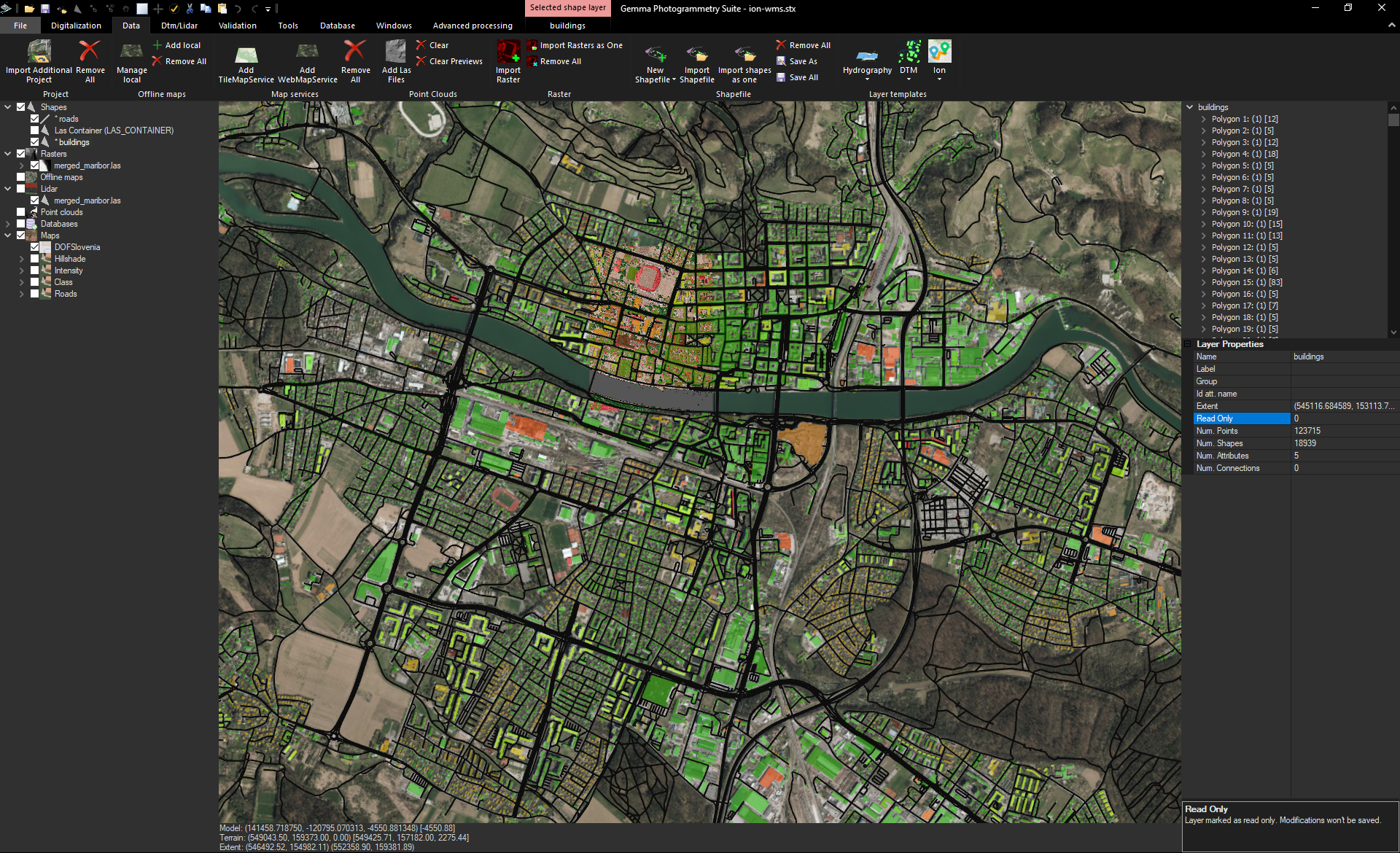
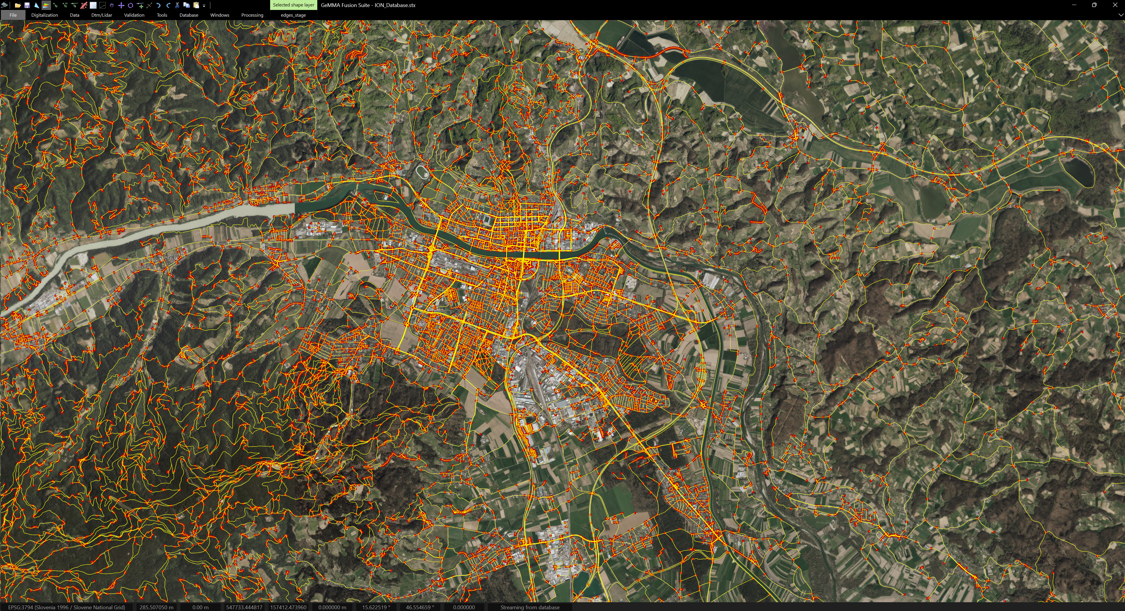
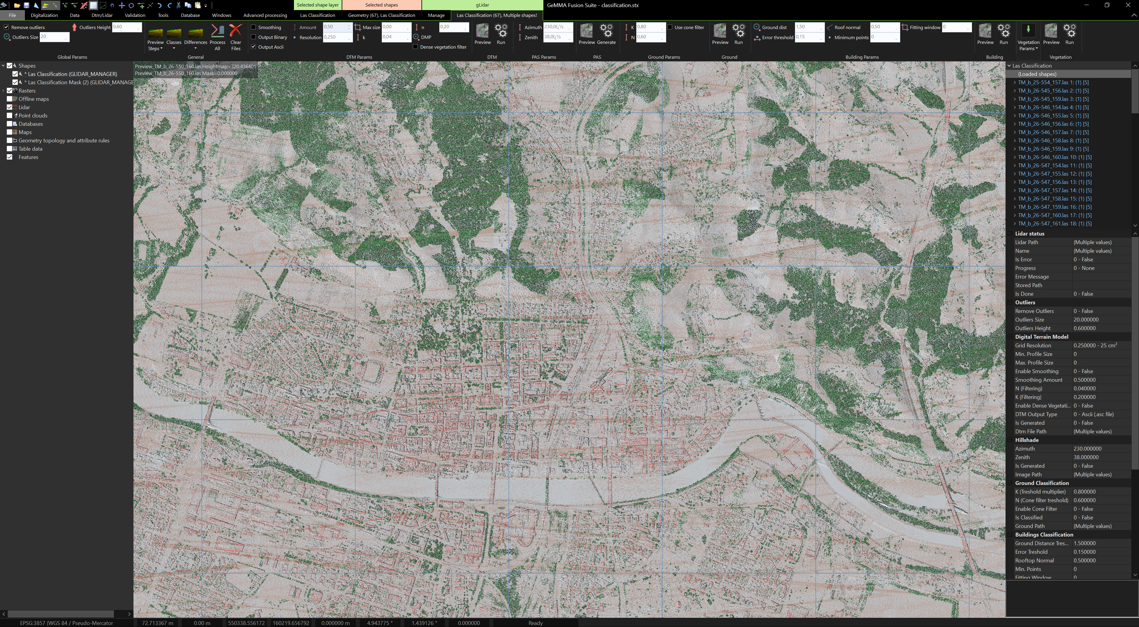
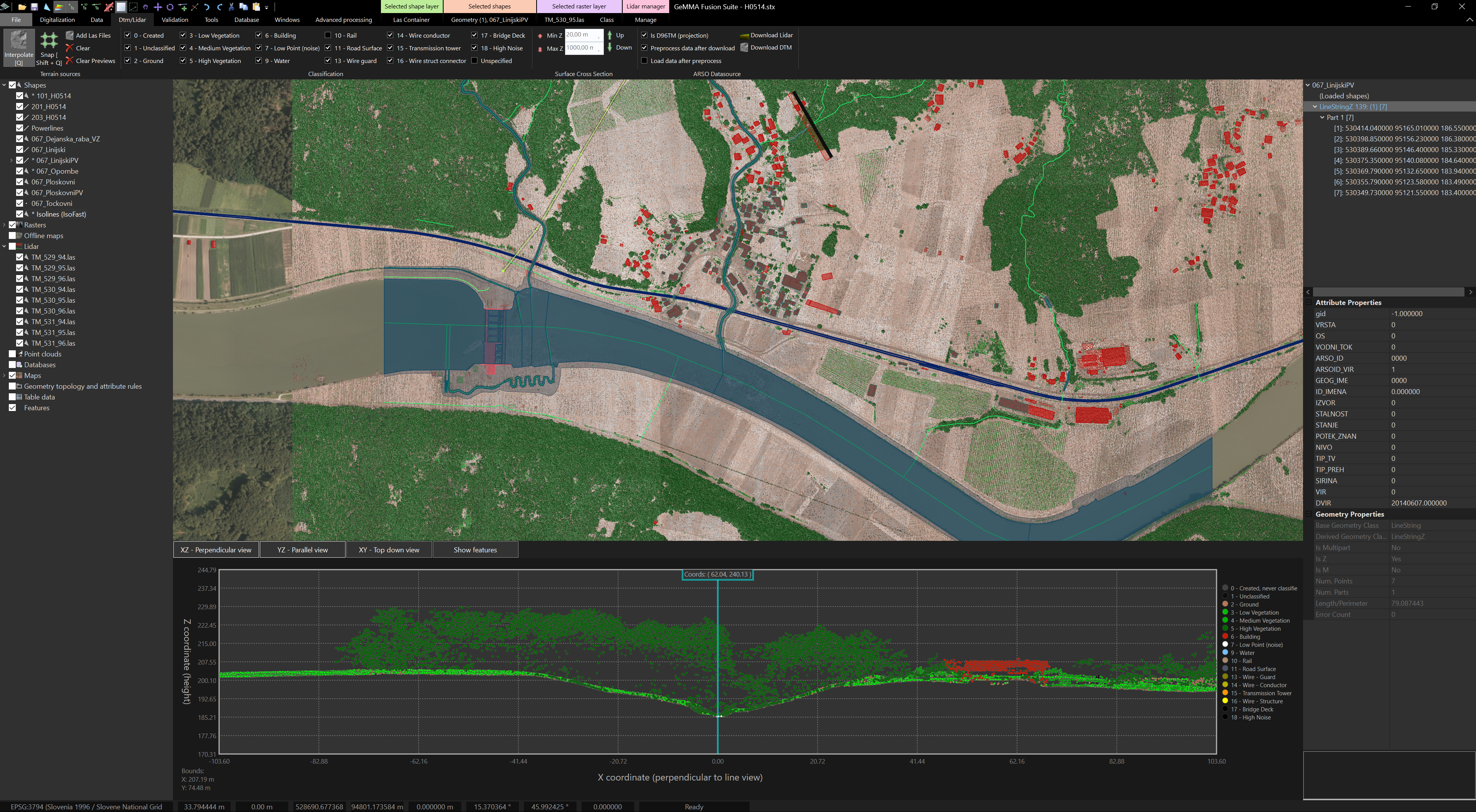
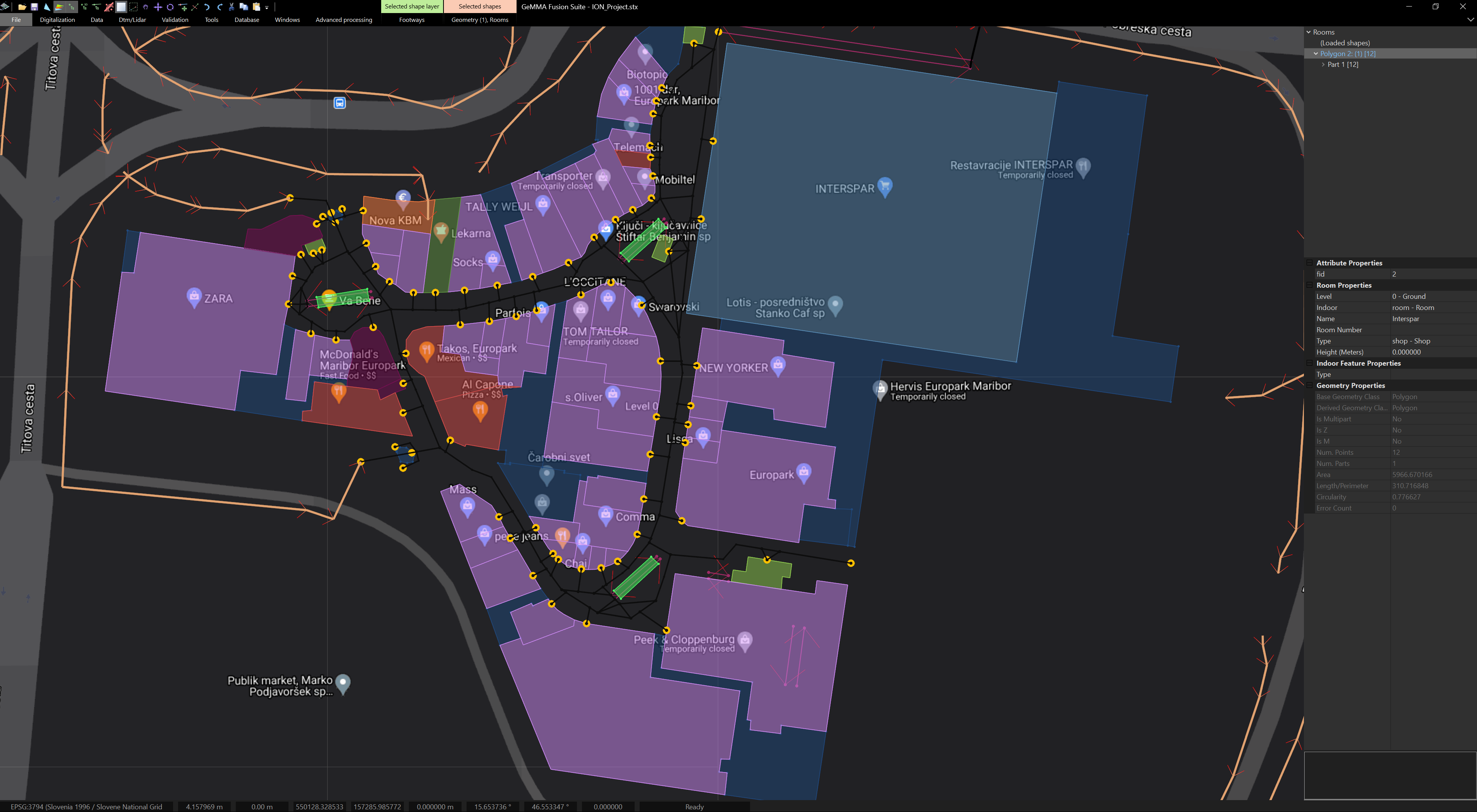
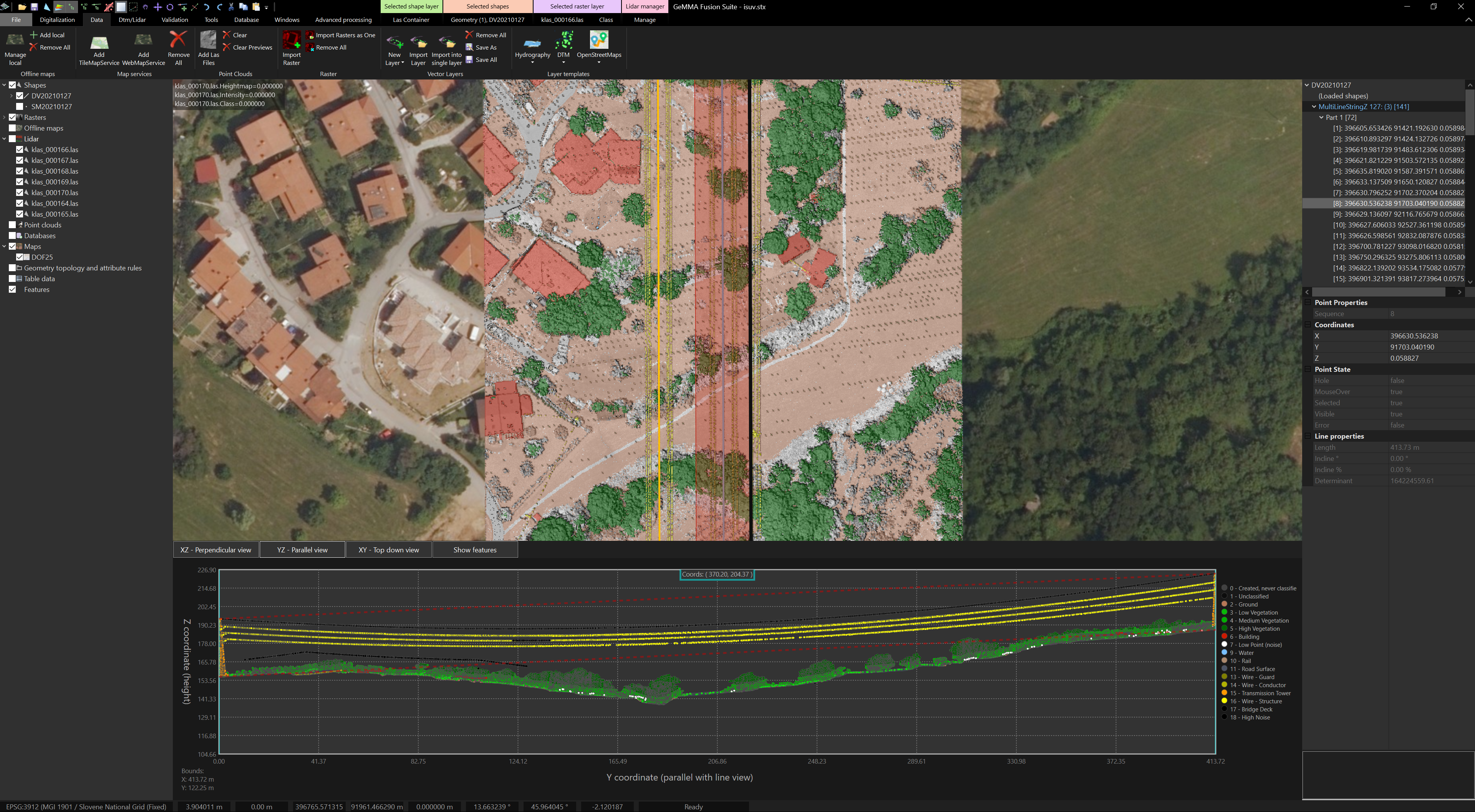
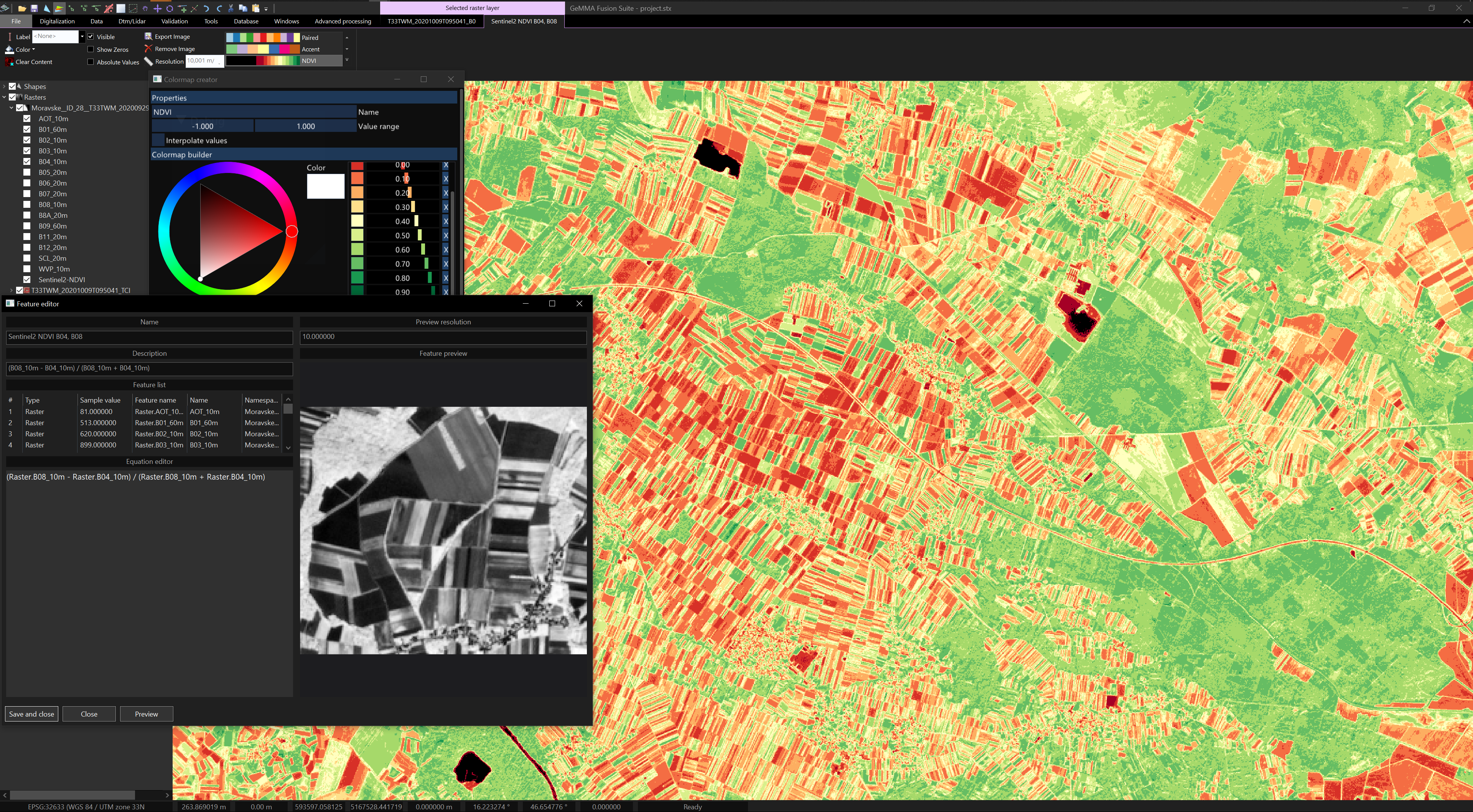
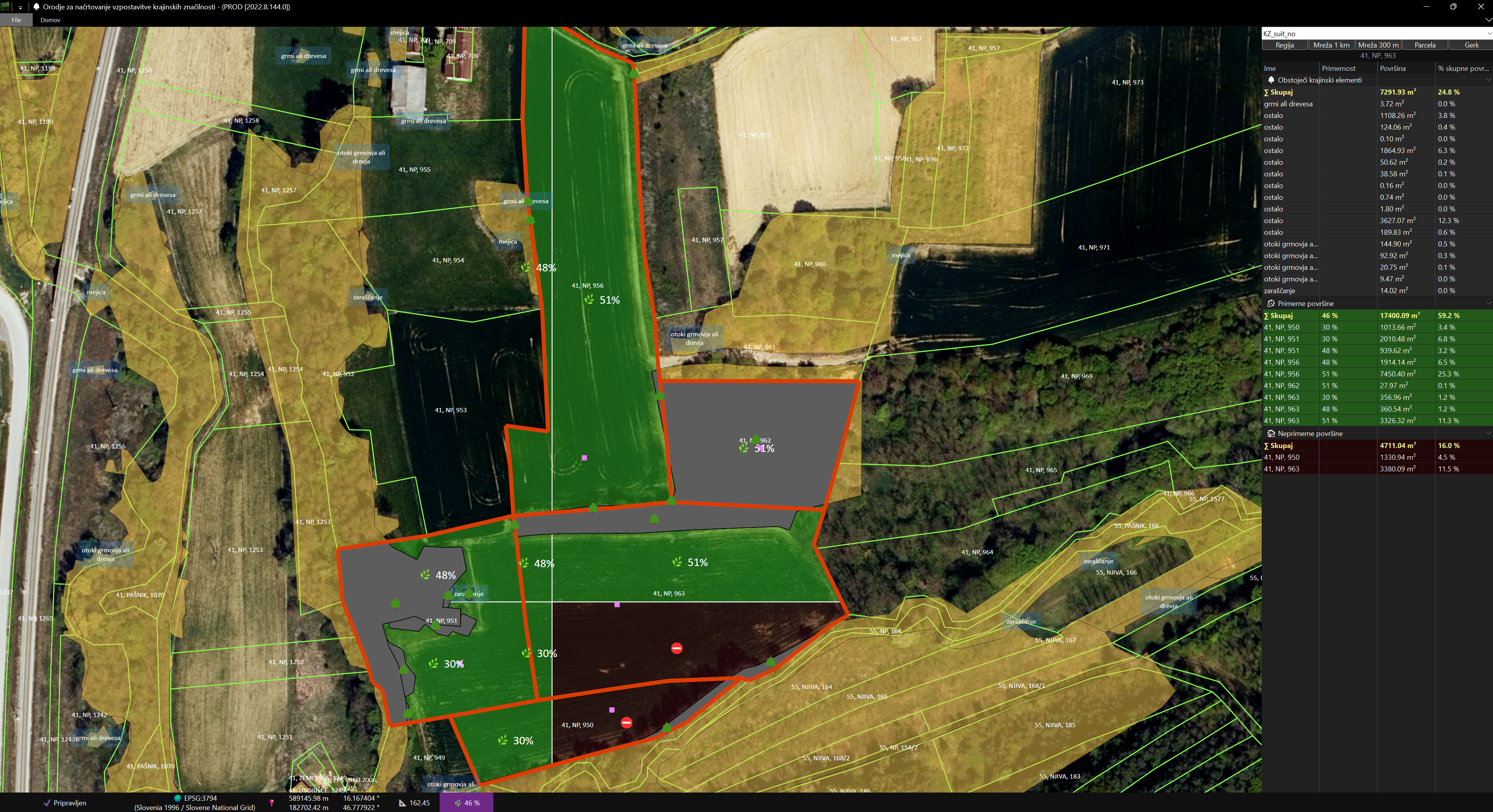
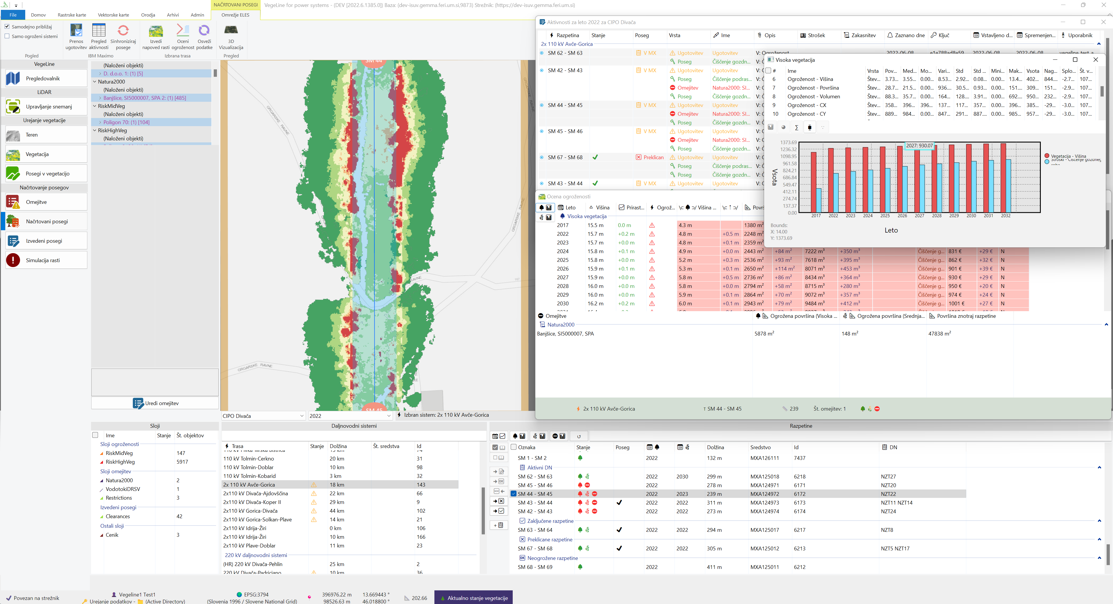
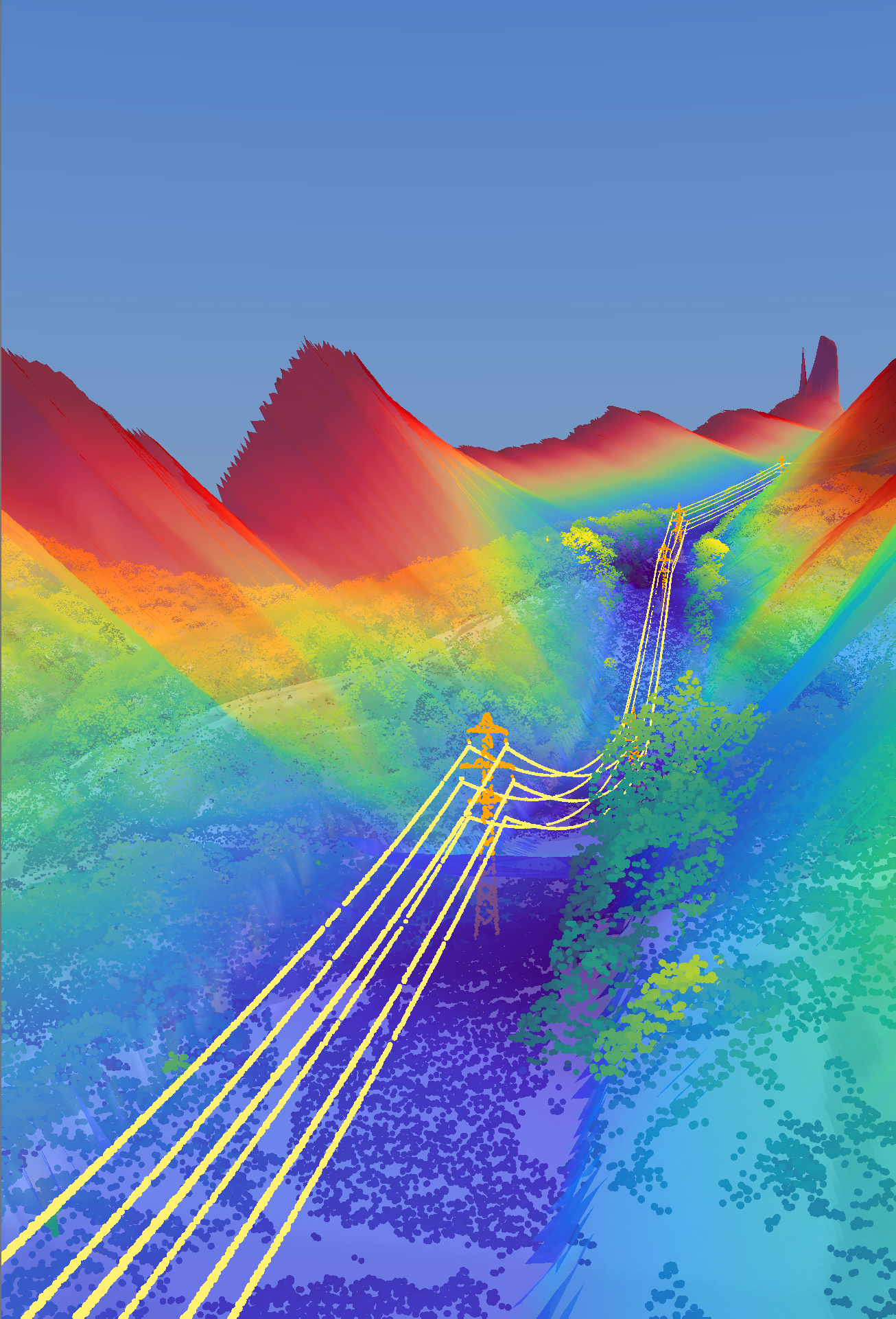
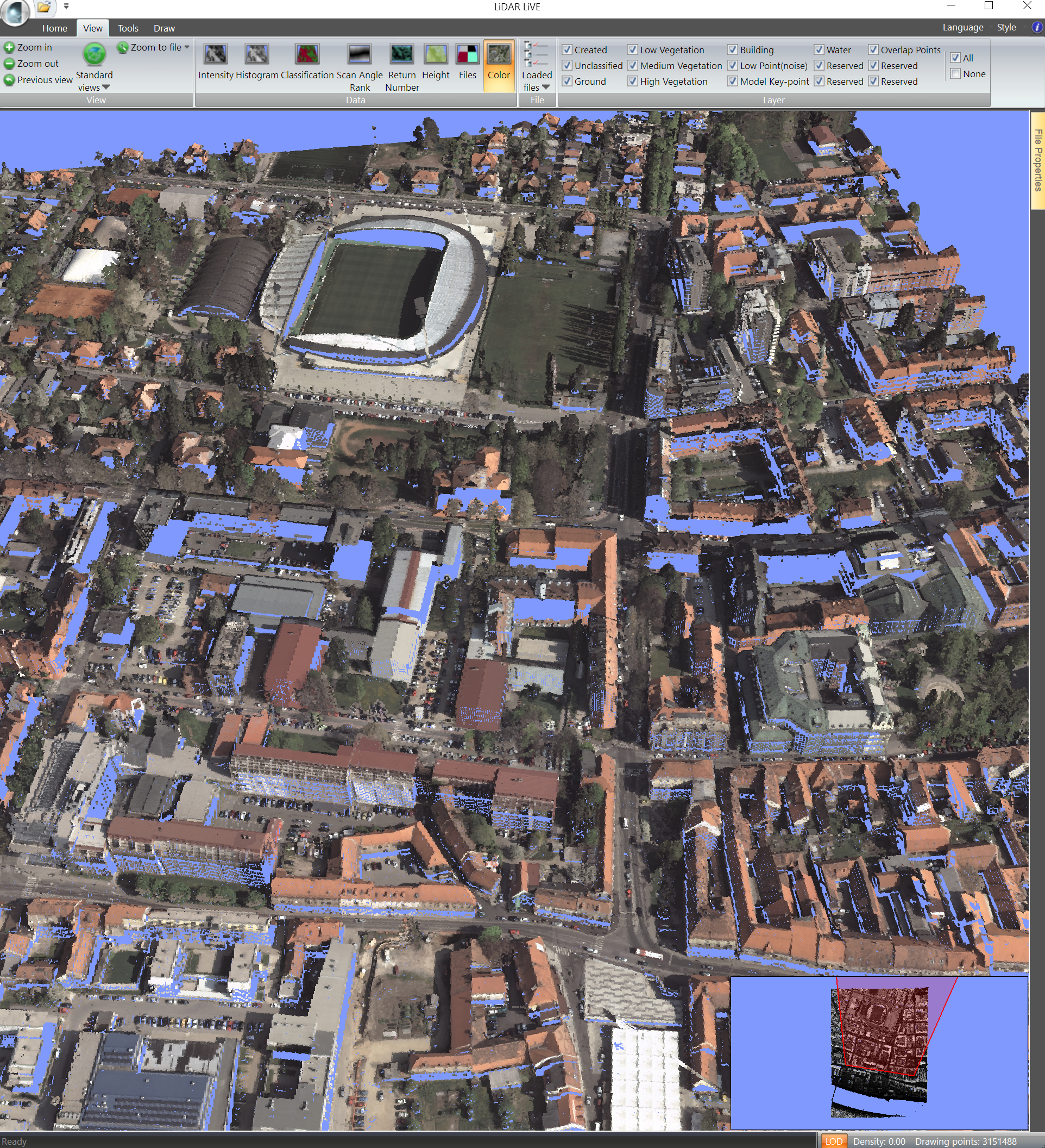
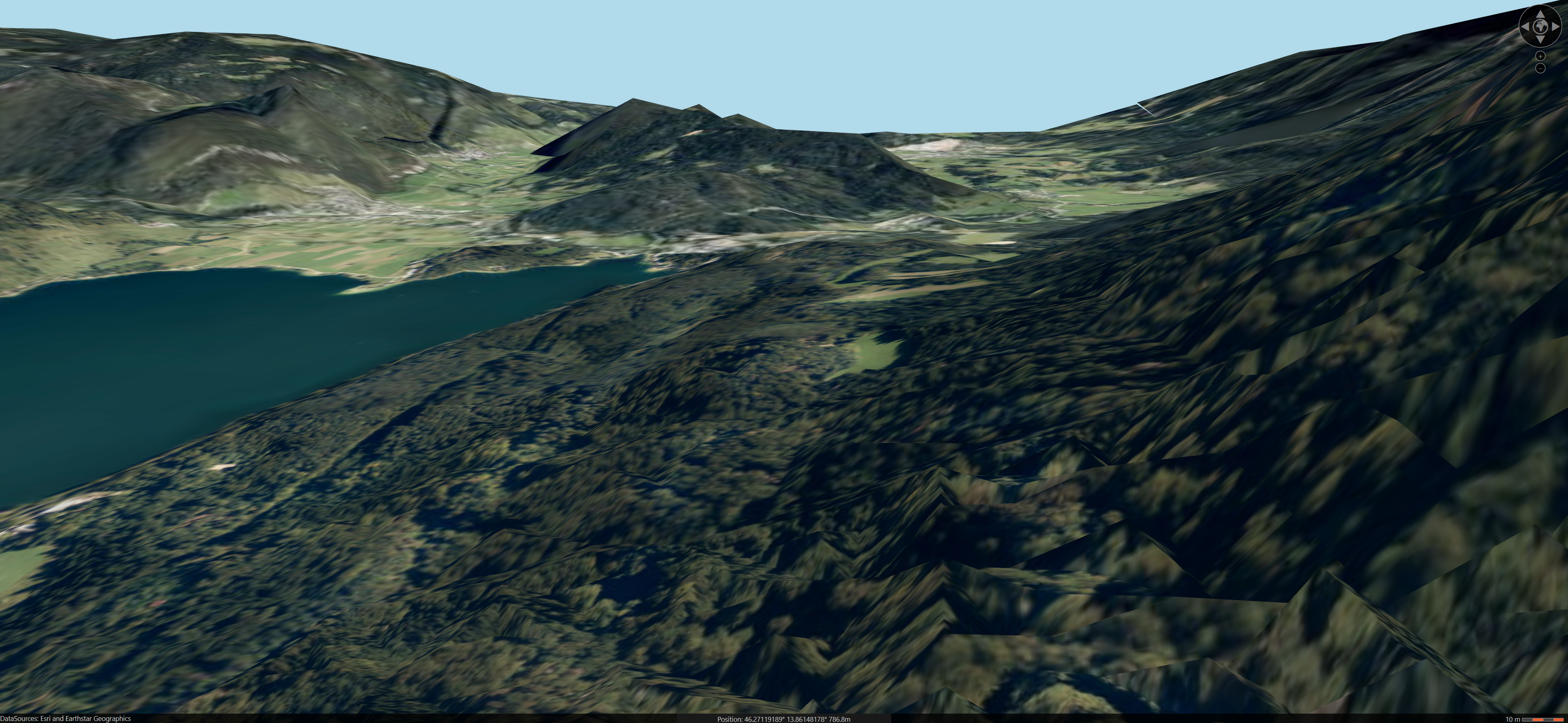
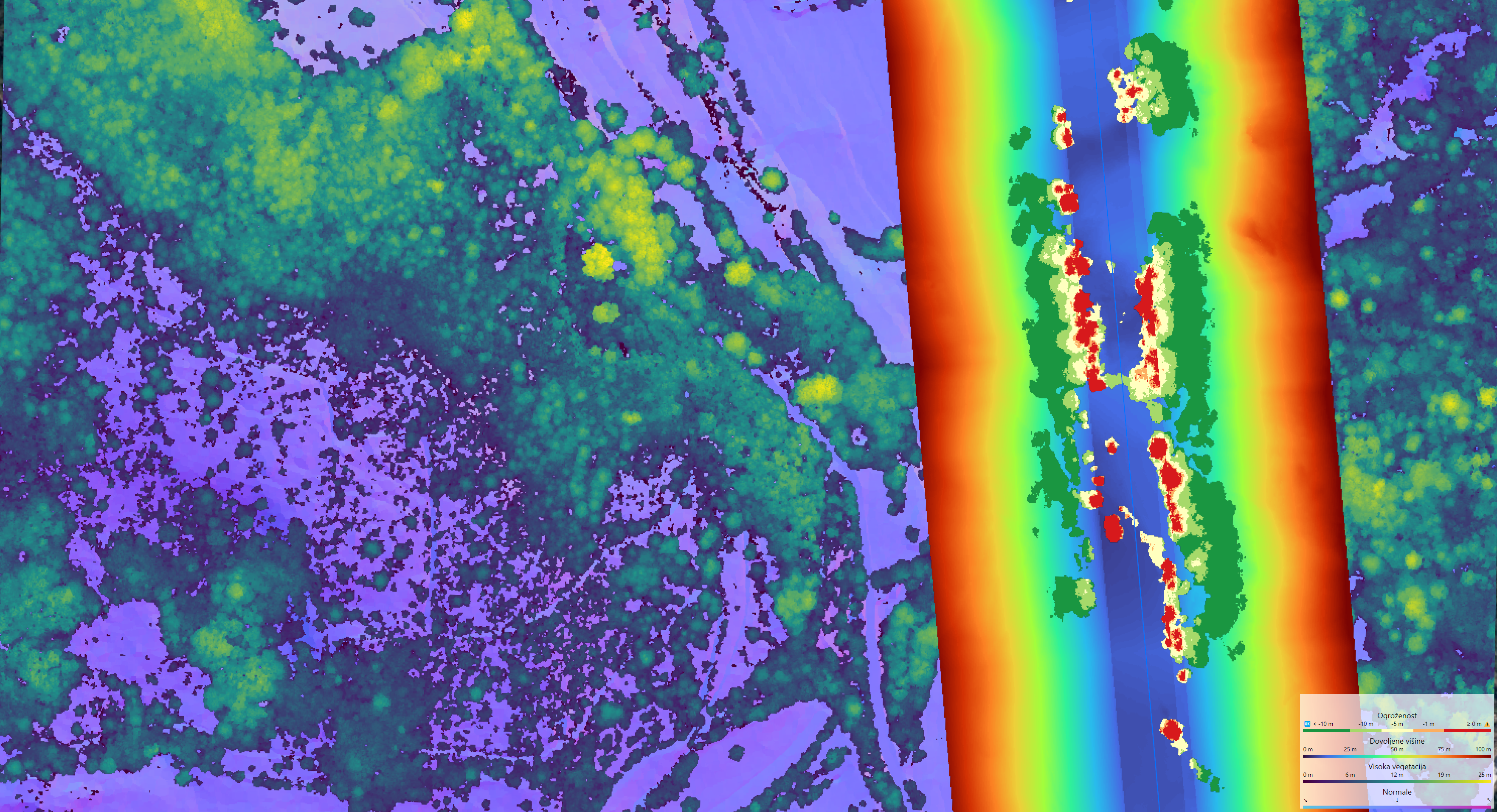
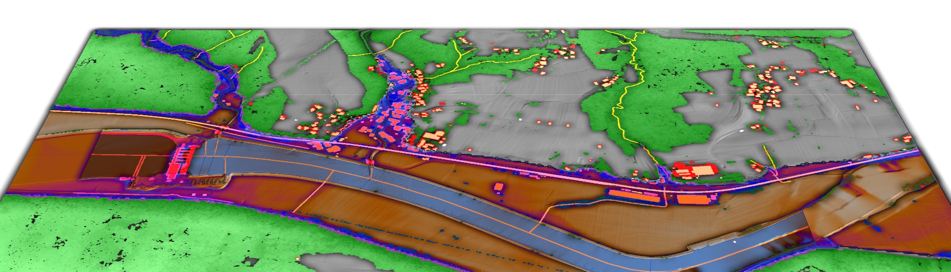
GeMMA Fusion Suite is advanced geospatial software SDK and tool designed and optimized for mapping of geospatial shape objects from heterogeneous sensory data streams and remote sensing data sources, such as digital ortophoto, lidar, digital terrain model and satellite imagery. GFS core consists of optimized readers and writers for standard data formats that allow for efficient async data IO operations and large-scale processing. Initiated by a growing number of studies conducted by GeMMA Lab with its industrial partners, GFS analytic engine is being constantly enriched by advanced data fusion methodologies and new location-intelligence algorithms. Over the years, codebase evolved into fully-fledged high-performance SDK to efficiently solve any given geoenvironmental and spatial data fusion problem.

Development of GFS was confunded by:

Architecture and components


As sown in figure above, GFS consist of the following system components:

Features

Gemma Fusion Suite contains many basic as well as advanced features which are easy to use. Most important feature is ability to load large quantities of multimodal data such as rasters, vectors and point clouds and group them into the workspaces (so called projects).

Supported data, databases and services:

Functionality

Advantages of GFS

In comparison to the competitors, GFS provides:

Existing clients

Following is the list of the existing users, with a short description of the means of their usage:

Potential users thus include individuals, companies, and public institutions that need to develop improved understanding of the environment for their business processes.

Showcases

Download

Source code, precompiled SDK and application releases can be found under internal GitLab repository, which is only available for the registered users bellow:

GemmaFusion Releases

For additional information, contact us via email at

gemma.feri@um.si